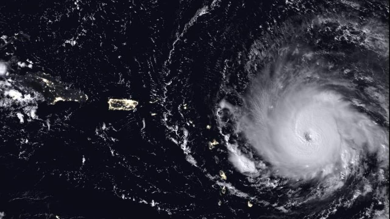
Hurricane Irma is threatening millions of lives in the Caribbean and Florida. Here's what we know about Irma and how hurricanes form:
Where do these storms comes from?
- Irma is a classic Cape Verde storm - which begin as a puff of unstable air and storminess off Africa's west coast and as they chug west across the warm Atlantic they evolve into powerful systems.
- Some storms fizzle out, some curve harmlessly north creating 'fish storms' in the mid-north Atlantic. Others start in the Gulf of Mexico, like Katia which formed off Mexico and was declared a hurricane on Wednesday. Another storm, Jose, has followed in Irma's footsteps.
Why are storms happening now?
- Hurricane season runs from June to November when the water is warm enough (minimum 26 degrees Celsius) and other conditions line-up for storms to build.
What's the average season like?
- Usually 12 named storms are produced each season, the National Weather Service says, with Katia the 11th so far.
- For a storm to be named wind speeds need to hit 63km/h.
- Six hurricanes are usually produced each season and three become major with wind speeds of 179km/h or higher.
- So far this season there's been six hurricanes: two major ones, Harvey and Irma; two new ones, Katia and Jose; and Franklin and Gert.
Did forecasters see this busy year coming?
- Yes. In May the weather service predicted a 70 per cent likelihood of 11 to 17 named storms with 5 to 9 becoming hurricanes.
Related reading

Three powerful hurricanes now in the Atlantic ocean: NHC
Are back-to-back big hurricanes unusual?
- This can happen, as with Matthew and Nicole last year, but it's strange for more than one to hit the US in one season.
- If Irma hits Florida as a category 4 or 5, it will be the first time on record that the US has been hit by two category 4 or 5 storms in one year, Colorado State University meteorology professor Phil Klotzbach said.
Why is Irma so strong?
- Warm water fuels hurricanes and Irma has been over deeper than usual water that is 0.7 to 1 degree Celsius warmer than normal. A lack of high altitude winds - which can fight storms - has also helped Irma intensify.
- While over the open Atlantic Ocean on Tuesday, Irma's 297km/h winds set a record for that region. In the entire Atlantic, Caribbean, and Gulf of Mexico, only Hurricane Allen in 1980 was stronger with 306km/h winds.
How unusual is Irma?
- Irma is only the second time since satellite-tracking began about 40 years ago that a storm maintained 297km/h winds for more than 24 hours, Klotzbach said. The other was the killer typhoon Haiyan that killed more than 6,000 people in the Philippines in 2013.
Is this global warming?
- Scientists take weeks or months to conduct intricate studies, using computer simulations, to see if a storm was worsened by man-made climate change. There have been a limited number of hurricanes since record-keeping began in 1851, which makes it difficult to do robust statistical analyses.
- But scientists have long said future global warming would make some of the worst storms stronger and wetter and recently have linked climate change to future rapid intensification of storms. There's been scientific debate over whether global warming means more storms, but the stronger and wetter is generally accepted by scientists.


