Southeast Queenslanders are bracing for "damaging and destructive" winds as Tropical Cyclone Alfred barrels towards the coast, with evacuations underway and schools, public transport and major roads to close.
The category two system is expected to make landfall late on Thursday or early Friday between Queensland's Sunshine Coast and Gold Coast.
The first cyclone to hit the state's southeast since 1974, Alfred will trigger heavy rain, flash flooding, destructive winds and storm surges with wild weather expected from Wednesday.
A Bureau of Meteorology (BoM) spokesperson said Alfred's crossing presented a "very rare and hazardous event for south-east Queensland".
"The wave, wind, rainfall and particularly the storm surge present significant risks," he said. "This situation is still evolving and the bureau will update our warnings for all of these hazards as the system approaches the coast."
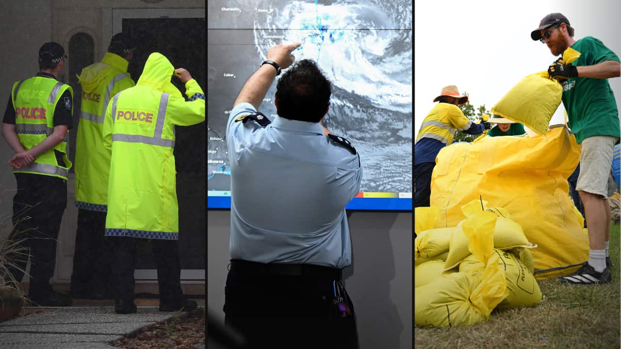
It is expected to cross the coast "at the higher end" of a category two storm, the BoM spokesperson said, though a "small percentage" of the agency's modelling suggested it could go stronger.
The cyclone's impact is also set to be felt interstate, with the warning zone spanning Double Island Point in Queensland to Yamba in northern NSW, south of Byron Bay.
Cyclone Alfred entering 'second phase'
Queensland Premier David Crisafulli urged residents on Wednesday afternoon to prepare their properties and finalise evacuation plans.
"There is the prospect that this cyclone could cross the coast in the middle of the night with a high tide, and that is not the time to be making your evacuation plan," Crisafulli said. "Now is that time."
He said the "second phase" of the cyclone was coming, bringing with it "damaging and destructive winds" that will come when the "cyclone crosses the coast".
Crisafulli signalled that there would likely be power outages, but contractors were on standby to "get power connected as quickly as we can".
People have begun fleeing their homes with about 70 evacuations from South Stradbroke Island, where the eye of the cyclone is set to loom early on Friday.

Large swells are seen at Snapper Rocks on the Gold Coast, Queensland, on Wednesday. Source: AAP / Jason O'Brien
"Our overwhelming advice to people is if it is possible to go and stay with a mate or a family member — or even if you do have the means and the capacity to go to a hotel — it is a far better option than an evacuation centre," Crisafulli said on Wednesday. "But they are there for people who are vulnerable and who might be new to the area and don’t have another option."
Aged care facilities in low-lying areas were being evacuated on Wednesday and authorities were working to accommodate the region's homeless.
The federal government has initiated defence force assistance with heavy-lift helicopters pre-positioned in Bundaberg and Coffs Harbour.
"This is a rare event to have a tropical cyclone in an area that is not classified as part of the tropics," Prime Minister Anthony Albanese said in Brisbane on Wednesday.
Albanese also confirmed an additional 250,000 sandbags would be delivered to the Queensland government.

Police walk door to door warning residents in Cleveland, in Brisbane's southeast corner, about impending Tropical Cyclone Alfred on Wednesday. Source: AAP / Jono Searle
Public transport in the southeast will be suspended from Wednesday night, and the Brisbane Regional Harbour Master warned no vessels are permitted on the water until further notice.
Southeast major roads and bridges to close once winds reach 90km/h, and more than 500 schools will close from Thursday in Queensland.

'An entirely different game'
Meanwhile, north-eastern NSW is bracing for "three natural disasters in one", according to the state's SES commissioner Mike Wassing.
"This is a very dangerous weather system impacting northern parts of the state," Wassing said. "We are dealing with three natural disasters in one — gale force winds, rainfall and flooding."
Significant localise flooding is possible along the Northern Rivers and Mid North Coast from Thursday, according to the SES. Severe rainfall is also expected to lead to moderate to major flooding along 13 river catchments across the state's north-east, including the Wilson's River at Lismore.
"You will recall the floods from . The worst-case scenario forecast by the Bureau of Meteorology's rain and flood modelling suggests we could reach a similar level," Wassing said.
"Floods at moderate and major levels in the past have seen many areas inundated, properties isolated, and thousands of people needing to evacuate."

People remove their possessions from businesses in Lismore, NSW, on Wednesday. Source: Getty / James D. Morgan
But he said the situation he faces now is an "entirely different game".
"What I've realised is all previously floods have been fairly still air, and now we're going to be dealing with 100km/h winds potentially," he said.
"So that's really changed my attitude. I'm not going to stay for the brunt of it, I'm going to take the boat and the trailer up on to dry land, wait for the major cyclone to go past, and then I'll come back into the water when the winds die down and it's safer to start moving around."
"We're recommending for other people who would normally stay and defend to get out and come back when it's safe."

Aidan Ricketts speaks to SBS News reporter Alexandra Jones on Wednesday. Source: SBS News
"If you need to move, we prefer you move earlier. Especially if you live in low-lying grounds. We say that is something that you could get onto as soon as possible," he said on Wednesday.
NSW Premier Chris Minns echoed those remarks.
"Thursday is the day to act because Thursday evening and Friday morning we're expecting the storm to approach and cross into NSW," Minns said.
— With additional reporting by the Australian Associated Press.