Heavy rain and heightened flood risk is and , with the rising water levels testing flood levees.
Two fresh weather systems are closing in on NSW, one expected to dump as much as 200mm of rain, prompting warnings of a "very dangerous" 48 hours ahead.
The latest evacuation orders have been issued for Moree as a major flood peak looms on the Mehi River, a tributary of the Gwydir River, threatening to surpass a 10.87m high mark recorded 67 years ago.
In all, there are 120 flood warnings current around NSW, 20 of them at emergency level.
Premier Dominic Perrottet pleaded with people to avoid driving through floodwaters, pointing to how the rescue of one motorist had recently tied up 20 emergency services volunteers.
"That is taking resources away from our emergency services and importantly, you are risking their lives," he said on Sunday.

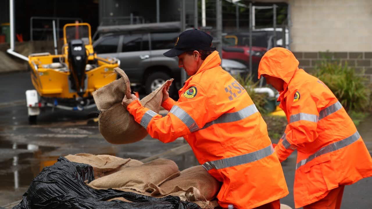
The state's SES had conducted 34 rescues and responded to almost 400 requests for help over 24 hours as of Sunday afternoon.
A man in his 30s died in a suspected drowning on Saturday at West Ballina, on the far north coast, while two men stranded in vehicles in the Southern Tablelands centre of Yass were rescued overnight.
Emergency Services Minister Stephanie Cook said there was a flood risk in "every corner" of NSW.
"We are facing a very dangerous 48 hours across NSW," she said.
One weather system is entering NSW from South Australia, bringing fresh rain, while another is hovering at the coastal Queensland border, which has the potential to dump up to 200mm on the already saturated Northern Rivers region.
Authorities say renewed thunderstorms have impacted multiple flood-affected communities along swollen rivers.
Most are in areas surrounding Moree, Gunnedah and the neighbouring village of Carroll on the northern Namoi River, the Riverina town of Narrandera on the Murrumbidgee and Moama on the Murray River.
The Bureau of Meteorology expects heavy rain over the state's northeast from Sunday morning, affecting Lismore, Grafton, Casino, Kyogle, Yamba and Maclean.
Falls of up to 150mm in six hours were possible in some areas.
The bureau's Jane Golding said the system at the NSW / Queensland border was an "evolving risk" and causing meteorologists concern.
"We will have to see how much rain the system produces," she said.
SES Commissioner Carlene York told people to follow evacuation orders.
"It is better to be inconvenienced for 48 hours and go back when we say it is safe," she said.
Crews will be performing rapid damage assessments to quickly give residents the green light to return.
Mr Perrottet said the flood's impact on the state's coffers was "difficult" but NSW had been in a good position before the COVID-19 pandemic to handle multiple crises.
"The NSW budget is not an end to itself, it is there to help families and people right across NSW," he said.
Two hundred Australian Defence Force personnel have been deployed in Dubbo, Moree and the Northern Rivers, with two additional ADF helicopters ready for night rescues.
Specialist swift-water rescue crews have also been dispatched to the flood-threatened north while others are in place on the Macquarie River, at Dubbo.
Levees tested as Victoria flood peaks arrive
Flood levees are being put to the test as swollen rivers peak or approach their peak in the northern Victorian towns of Echuca and Kerang.
The Murray River surpassed the 1993 flood level of 94.77 metres above sea level at Echuca on Saturday and is forecast to peak around 95m on Sunday evening into Monday.
Twenty homes in and around Echuca Village were door-knocked on Saturday night after water seeped through a levee.
"Those levees, whilst they're holding at this point in time, do continue to be a vulnerability for that particular community," State Emergency Service Victoria's Tim Wiebusch told reporters on Sunday.
Engineers have checked the Victorian-NSW border town's three-kilometre temporary dirt levee and it remains structurally sound.
"We can't always guarantee that they will hold in all types of scenarios and hence why we have an evacuation message out," Mr Wiebusch said.
The alert covers between 500 to 700 people living across 250 properties in the area. Some roads in Echuca have been closed but emergency services still have access for supply chains.
Further northwest, the Loddon River at Kerang has peaked below the 78m forecast at 77.97m but the threat is yet to pass.
Floodwaters have only slightly receded and aren't expected to noticeably drop for five to seven days, keeping the community isolated.
A levee in the southwest corner of the town has been breached, sending water into an industrial area, caravan parks and about 20 homes.
However most parts of Kerang remained dry at this stage, Mr Wiebusch said.
About 50 to 60 per cent of the 3000-strong local community have remained behind to protect their properties.
Premier Daniel Andrews has pleaded with residents in Echuca and Kerang to heed evacuation advice.
"Please give that very careful thought. We don't issue those warnings lightly," he said.
About 50 flood victims from across the state have taken refuge at the Mickleham quarantine centre, as more than 65 warnings remain active.
Meteorologist Michael Efron said a weather system is predicted to dump 15mm to 30mm of rainfall on parts of northern and western Victoria on Monday, before contracting on Tuesday and remaining mostly clear from Wednesday to Saturday.
But Mr Wiebusch said the Campaspe River at Rochester could return to moderate or major flood levels early next week, if upper-end rainfall predictions come to fruition.
"It could impact about 50 properties," he said.
Downstream from Echuca, the Murray River is expected to peak at major flood levels higher than 1993 and 2016 from Torrumbarry to Barmah on Wednesday and Thursday.
Major flooding isn't expected to hit Swan Hill until the first week of November.
The SES has received more than 8700 calls for help since the weather emergency began, including more than 750 for flood rescues.