Key Points
- Researchers have a better understanding of what Australia was like 65,000 years ago before two sea level rises.
- They conclude Australia was once part of a super-continent that was populated by between 50,000 and 500,000 people.
- The team says the discovery sheds more light on the human migration story out of Africa and into Australia.
Research by underwater archaeologists has yielded new insights on the environment, culture and human population that existed 65,000 years ago in Australia.
Back then the Australian mainland was part of a single mega-continent that also included Tasmania and New Guinea.
For archaeologist Kasih Norman, it has been a research project six years in the making.
"Essentially, you're doing time travel with this sort of work, which makes it incredibly exciting," she tells SBS News.
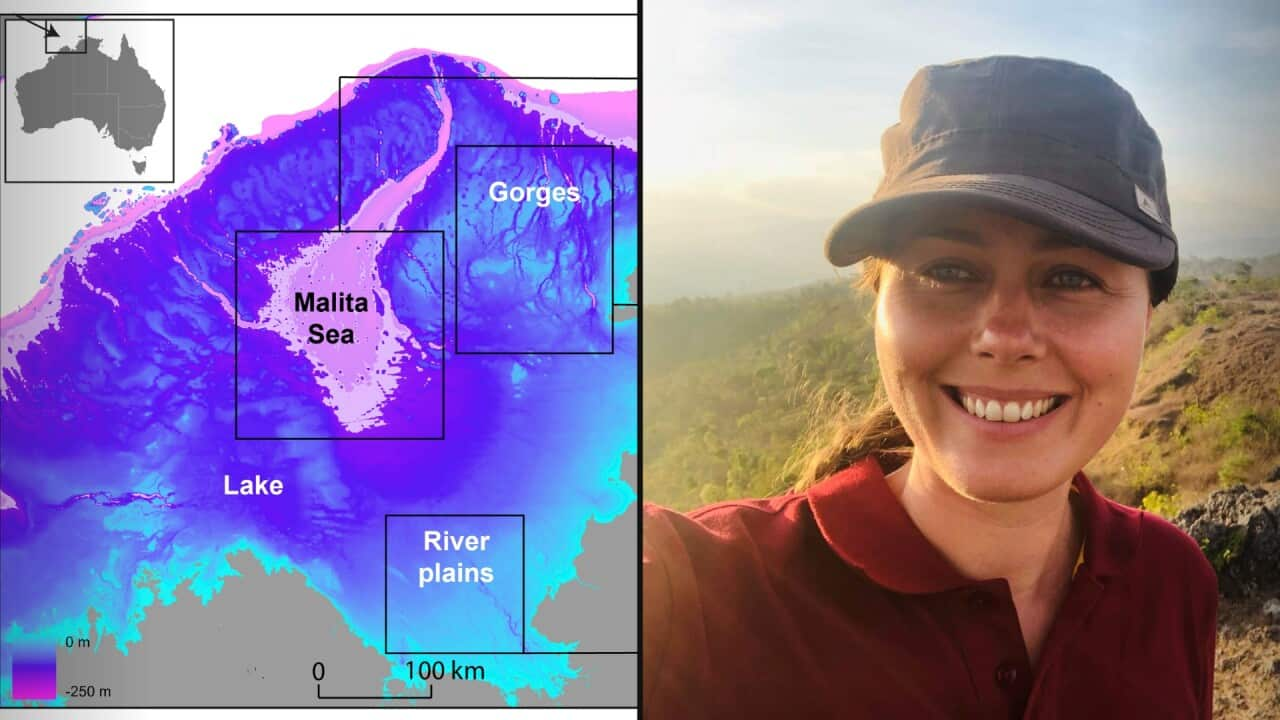
Analysis of ocean floor mapping data released by Geoscience Australia revealed insights on Australia's submerged landscapes when sea levels were lower 65,000 years ago. The research is published in

About 65,000 years ago, Australia was part of a large landmass, which joined New Guinea and Tasmania to the Australian mainland. Source: Supplied / Kasih Norman
"We were able to see that between 70,000 and 61,000 years, sea levels dropped for a while and this vast archipelago emerged. It stretched between the Kimberley and Arnhem land and 500 kilometres out towards the Indonesian island of Timor."
Two rapid sea level rises drastically changed the landscape, but when sea levels were much lower, a new landscape emerged.
"And once this whole landmass became exposed, it's absolutely gigantic. It's one and a half times the size of New Zealand," Norman said.
"And at the last glacial period (20,000 years ago), there was a huge inland sea that formed, and it only had a marine connection to the Indian Ocean through this 200-kilometre canyon basically called the Malita Valley.
"And so we had this completely contained inland sea in Northwest Australia, which basically formed a landscape unlike any that we have in Australia today."

About 200,000 square kilometres of land was lost in two major sea level rises. Source: Supplied / Kasih Norman
That group could have been as large as 500,000 at one point, according to the team's demographic modellers.
The population was forced to retreated in the face of two rapid sea level rises that swallowed up to 200,000 square kilometres of land.
"Multiple lines of evidence" combined - including the discard of stone tools and appearance of new rock art styles in the Kimberley and Arnhem land - to form a picture of what appeared to have happened.
"And they've been dated to these quite tight windows now that align really nicely with those two periods of very rapid sea level rise. So it does begin to give the appearance that yes, we do have people out in this productive landscape.
"We know it could have been capable of supporting these large populations, and we can see in the rock art and the archaeology that it actually looks like we are seeing the signature of people kind of being pushed back ahead of that encroaching coastline."
The work also provides clues on the potential pathway of human migration out of Africa into Australia , when the first evidence of human occupation in Australia was connected to Arnhem land.
"That vast archipelago does emerge between 70,000 and 61,000 years ago. So it really encapsulates that initial window of occupation. It doesn't mean people did cross there, but it does mean that there's an opportune crossing window for people to move from Indonesia to Australia at this point."
The experience of First Nations Australians with sea level rises in the past could also have lessons for current challenges.
"It's very clear that climate change had a really big impact on deep time Australians and they responded in very innovative ways. We should really start to think about that in our approach to how we might have to adapt in the future."


